National Map Point Selection

( Only works on 1/3 arc second gridfloat files )

What happened to all the old USGS DEM files ? ? ?
If you still have DEM files, see my old DEM Point Selection page.


Latest Update Dec 2, 2021
The National Map no longer has gridfloat file downloads.
You have to download the 1 degree GeoTiff file and extract
the *flt & *hdr files using GDAL.

Installation instructions for GDAL can be found HERE.

Instructions to extract gridfloat and header files can be found HERE.

Exe files updated (V3) to also read *.hdr files written by GDAL.


Nedwv3.exe Point Selection

( Get points by window selection )


You can't select points until you zoom in to a 7.5 minute window.
The window below shows the maximum number of points you can extract.
You can zoom to a 5 or 2.5 minute window and pan across 7.5
minute lines, but the lat/lon marks disappear.

If you need an area larger than 5 minutes that crosses the 7.5
minute lines, try the program below that uses upper left lat / lon
and distance east / south to select points.


You can reduce, but not increase the number of col / rows selected.
You can estimate the output file size based on # of col / rows removed,
coordinate input and / or file type.


National Map Download

This program only works on 1/3 arc second
GridFloat files from the National Map.
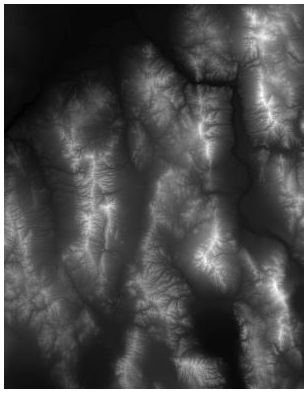
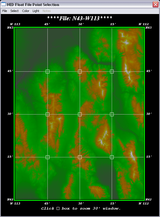

JPG for N43W113

GridFloat files no longer exist as
a direct download. They have to be
extracted from 1/3 arc sec. GeoTiff files
downloaded from the National Map.

Installation for GDAL can be found HERE.

Instructions to extract files can be found HERE.

Program Notes

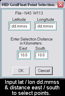
This program extracts points and attempts to match the ground under your feet, but you'll
have to enter your own coordinate system.  See description below.

USE AT YOUR OWN RISK !

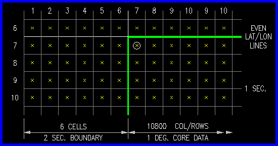
You only need to extract the header (*.hdr) and float (*.flt) files into the same directory.
The *hdr is a small text file that defines the lat / lon,  number of cols / rows,  approx. cell spacing, etc.
The *flt is a 4 byte floating point file with 10812 cols / rows of elevation data. (467597376 bytes)
Each file has a 2 second (6 pt) overlap boundary around the core data.  UL data pt = row7, col7.


This program uses the dimensions for each 1 degree of latitude and longitude from the following web site.
www.movable-type.co.uk/scripts/latlong-vincenty.html

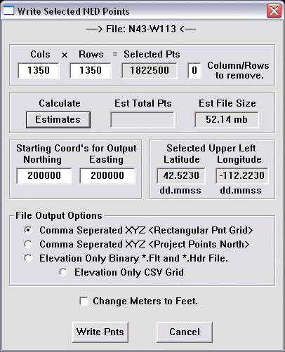
If you project points north it creates a trapezoid from the North West point selected.   Rectangular
grids use the distance at the center of points selected for all E-W point distances.  N-S point distances
are slightly different from file to file.  It's not supposed to be perfect.  Just close enough.

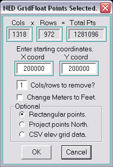
If you don't like these point definitions, you can write an elevation only comma separated (*.csv)
point grid or a binary (*.flt/*.hdr) file to define the points differently.  The *.hdr file
defines the upper left point and the cellsize depends on the number of col / rows removed.


Right click and "Save Target As" to download both files  NED_VER3.ZIP (84,205 bytes)


Nedbv3.exe Point Selection

( Get points by lat/lon and distance east/south )


WARNING !

This progam has no limitations on how many points it will write.
It only warns you once if you write more that 200K points, but will
actually write all 116 million points in any file if you're not careful.

It can take along time to write that many point so have patience if you do.
It took my old 1.8Ghz laptop 10 minutes to write all 116M points and 4.2 GB of data.

USE AT YOUR OWN RISK !

Right click and "Save Target As" to download both files  NED_VER3.ZIP (84,205 bytes)


Other Links

Go to Contour Lisp Page.

National Map  download page.

Back to Home Page.